Skip to content
Mada Car Drive — logo
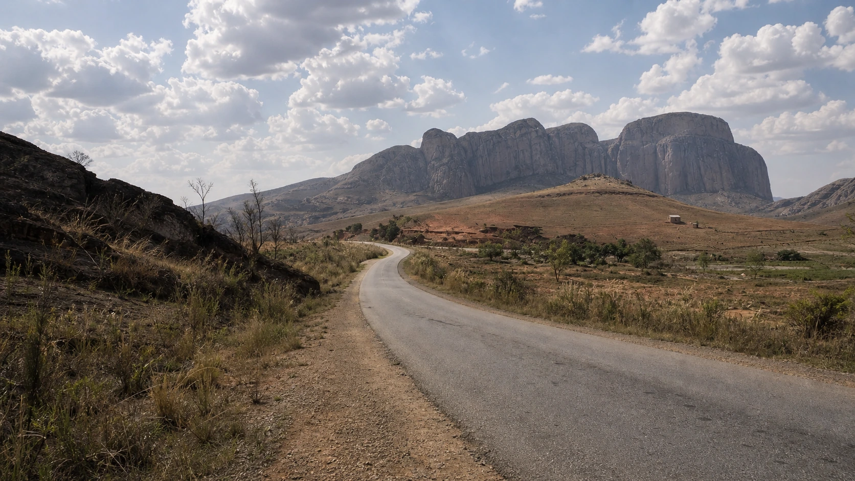
Winding RN7 through the dry mountain landscape of southern Madagascar

ROUTE · RN7 & THE SOUTH · 14 DAYS

14 Days on Madagascar’s RN7: Ranomafana, Isalo & Ifaty

From the highlands through rainforest and Isalo sandstone to the lagoon at Ifaty: 14 well-paced days in southern Madagascar.

14 daysduration
4x4with driver
May–Octoberbest window
Isalohighlight

RN7 · SOUTHERN MADAGASCAR · 4x4 WITH DRIVER

A 14-day journey south along the RN7

The RN7 is Madagascar’s great journey south. It begins in the cool highlands, crosses terraced rice fields and lively towns, enters dense rainforest at Ranomafana and reaches the broad, dry landscapes of Isalo beyond Ambalavao.

Fourteen days give this variety the right rhythm. You can encounter lemurs in the rainforest, ring-tailed lemurs among granite boulders, natural pools in Isalo and, finally, the calm lagoon at Ifaty. There is also time for markets, crafts and the small encounters that happen along the road.

You travel by 4x4 with an experienced driver. The driving times are a guide only: in Madagascar, road conditions, traffic and weather matter just as much as distance.

14 STAGES · HIGHLANDS · RAINFOREST · ISALO · COAST

The route at a glance

  1. 01

    Arrival in Antananarivo

    Ivato Airport · Antananarivo

  2. 02

    Through the central highlands to Antsirabe

    Antananarivo → Antsirabe

    approx. 170–190 km · approx. 5–7 hours

  3. 03

    Antsirabe and Lake Tritriva

    Antsirabe · Lake Tritriva · surroundings

    local drives · day excursion

  4. 04

    Via Ambositra to the rainforest

    Antsirabe → Ambositra → Ranomafana

    approx. 240–250 km · approx. 7–9 hours with stops

  5. 05

    A full day in the rainforest

    Ranomafana · national park

    local transfers · hiking and nature day

  6. 06

    From the rainforest to Fianarantsoa

    Ranomafana → Fianarantsoa

    approx. 60–70 km · approx. 2–3 hours

  7. 07

    Betsileo culture and crafts in Ambalavao

    Fianarantsoa → Ambalavao

    approx. 55–60 km · approx. 1.5–2 hours

  8. 08

    Ring-tailed lemurs at Anja and onwards to Ranohira

    Ambalavao → Anja → Ihosy → Ranohira

    approx. 230–250 km including access road · approx. 5–7 hours driving, plus the visit

  9. 09

    Canyons, forest and water in Isalo

    Ranohira · Isalo National Park

    local transfers · full hiking day

  10. 10

    Experience Isalo without rushing

    Ranohira · Isalo · surroundings

    local transfers · experience day without a long onward drive

  11. 11

    From Isalo to the southwest coast

    Ranohira → Sakaraha → Toliara → Ifaty

    approx. 275–300 km · approx. 7–9 hours with stops

  12. 12

    Lagoon, Vezo coast and Reniala

    Ifaty · Mangily · coast

    local drives · coast and relaxation day

  13. 13

    Flight to Antananarivo with a safety buffer

    Ifaty → Toliara Airport → Antananarivo

    approx. 30–40 km by road · approx. 1–2 hours transfer plus flight

  14. 14

    Departure or extension

    Antananarivo · Ivato Airport

    transfer depends on the accommodation · depends on departure time and traffic

All distances and driving times are approximate. Traffic, road conditions, weather, park access and stops can change the actual course of the day.

THE JOURNEY IN DETAIL

Day by day

01

DAY 01 · IVATO AIRPORT · ANTANANARIVO

Arrival in Antananarivo

After landing at Ivato Airport, you travel first to your accommodation. The view from the vehicle already reveals rice fields, brick houses and the hills of the central highlands.

The first day is for arriving: leave your luggage, change some money, have something to eat and recover from the international flight. If you land early, there may be time for a short walk or a first look at Antananarivo.

The road trip itself begins the following morning. Rested, you leave the capital and follow the RN7 south.
02

DAY 02 · ANTANANARIVO → ANTSIRABE

Through the central highlands to Antsirabe

Distance
approx. 170–190 km
Driving time
approx. 5–7 hours

Beyond Antananarivo, the central highlands open out. Terraced fields cover the slopes, red clay houses stand between rice paddies and small market towns line the road.

The view from the window is at least as rewarding as the next stop. Traders carry goods to the roadside, zebu carts cross village streets and a new highland panorama appears beyond every rise.

You reach Antsirabe in the afternoon. Pousse-pousses define the street scene, old façades recall the city’s spa-town history and small workshops create objects from horn, wood and metal.

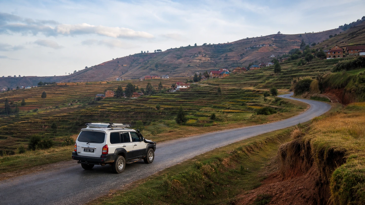
White Mada Car Drive Hyundai Terracan on the RN7 between highland rice fields
The Mada Car Drive Terracan travelling between terraced rice fields and highland villages.
03

DAY 03 · ANTSIRABE · LAKE TRITRIVA · SURROUNDINGS

Antsirabe and Lake Tritriva

Distance
local drives
Driving time
day excursion

The morning offers a closer look at Antsirabe. Around the old station, markets and workshops, the city feels busy while retaining a pleasantly unhurried highland rhythm.

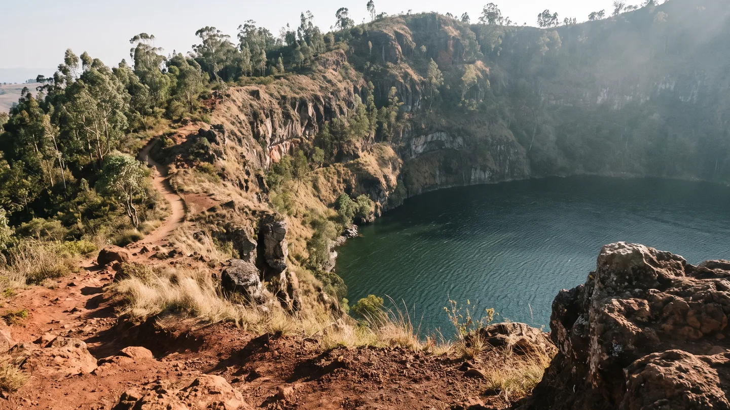
You then leave for Lake Tritriva. The road narrows through fields and villages before ending at a dark crater lake set deep in a volcanic landscape.

A path around the crater rim opens changing views across the water and surrounding hills. In the afternoon, you return to Antsirabe for a second evening in the highlands.

Lake Tritriva crater lake southwest of Antsirabe
Lake Tritriva lies in the volcanic landscape outside Antsirabe.
04

DAY 04 · ANTSIRABE → AMBOSITRA → RANOMAFANA

Via Ambositra to the rainforest

Distance
approx. 240–250 km
Driving time
approx. 7–9 hours with stops

South of Antsirabe, the highlands grow wilder and more winding. Rice fields lie deep in the valleys, villages cling to the slopes and the tradition of woodcarving remains visible around Ambositra.

After turning towards Ranomafana, the landscape changes markedly. The air becomes more humid, ferns and dense forest draw closer to the road and mist hangs over green mountain slopes.

You reach Ranomafana in the late afternoon. The sound of the river and damp forest air already announce the national park that takes centre stage the next morning.

05

DAY 05 · RANOMAFANA NATIONAL PARK

A full day in the rainforest

Distance
local transfers
Driving time
hiking and nature day

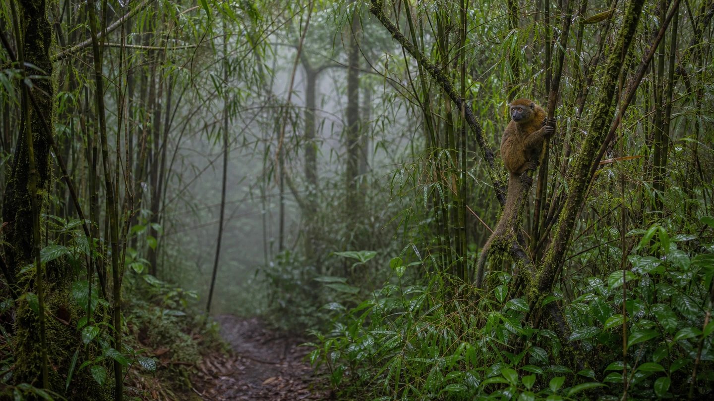
The walk in Ranomafana National Park begins early. Narrow trails lead between bamboo, tree ferns and moss-covered trunks into a rainforest alive with sound and movement.

With a local guide, you look for lemurs, chameleons, frogs and birds. Sometimes only a rustle in the leaves gives away a group moving through the canopy. Wildlife sightings always remain a gift of nature.

After the walk, you return to Ranomafana. A quiet afternoon or a soak in the town’s warm water provides a relaxed end to the rainforest day.

Golden bamboo lemur in the humid rainforest of Ranomafana National Park
With a local guide, the search for lemurs leads deep into the humid mountain rainforest.
06

DAY 06 · RANOMAFANA → FIANARANTSOA

From the rainforest to Fianarantsoa

Distance
approx. 60–70 km
Driving time
approx. 2–3 hours

The road leaves Ranomafana’s humid valleys and climbs back into the highlands. Rice fields, small villages and viewpoints across the green slopes appear between the bends.

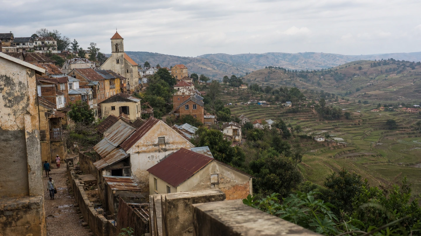
Fianarantsoa spreads across several hills. In the historic upper town, narrow lanes rise between old houses and churches, repeatedly opening views across the lower districts and surrounding rice fields.

The short road stage leaves time for a walk and a slow afternoon. Cafés, markets and views over Betsileo country make Fianarantsoa far more than an overnight stop.

Historic upper town of Fianarantsoa above terraced rice fields
Fianarantsoa’s historic upper town lies on hills above the rice fields of Betsileo country.
07

DAY 07 · FIANARANTSOA → AMBALAVAO

Betsileo culture and crafts in Ambalavao

Distance
approx. 55–60 km
Driving time
approx. 1.5–2 hours

Only a short stage separates Fianarantsoa from Ambalavao. Old houses with verandas and immense granite mountains immediately mark the transition from the highlands to the south.

Workshops make flower-pressed Antemoro paper, while elsewhere silk is spun and woven. On Wednesdays, the large zebu market brings traders and animals together from across the region.

The afternoon leaves time to walk through town, discover local crafts and enjoy the mountain backdrop. Ambalavao is one of those stops where culture and landscape meet directly.

08

DAY 08 · ANJA RESERVE → IHOSY → RANOHIRA

Ring-tailed lemurs at Anja and onwards to Ranohira

Distance
approx. 230–250 km including access road
Driving time
approx. 5–7 hours driving, plus the visit

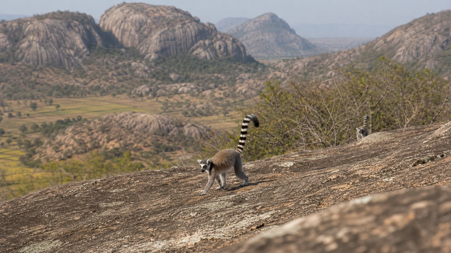
In the morning, a local guide leads you through Anja Community Reserve. Ring-tailed lemurs move between patches of forest and sun-warmed granite boulders, with rice fields and small villages below the mountains.

After the walk, the RN7 continues south. Beyond Ihosy, the landscape becomes broad and dry: grassland stretches towards the horizon, isolated massifs rise from the plain and villages lie farther apart.

The sandstone formations of Isalo appear towards evening. Ranohira lies directly beside the national park and becomes the base for the coming hikes.

Ring-tailed lemurs on granite boulders in Anja Community Reserve
Ring-tailed lemurs, granite boulders and rice fields define the community-managed Anja Reserve.
09

DAY 09 · ISALO NATIONAL PARK · NAMAZA

Canyons, forest and water in Isalo

Distance
local transfers
Driving time
full hiking day

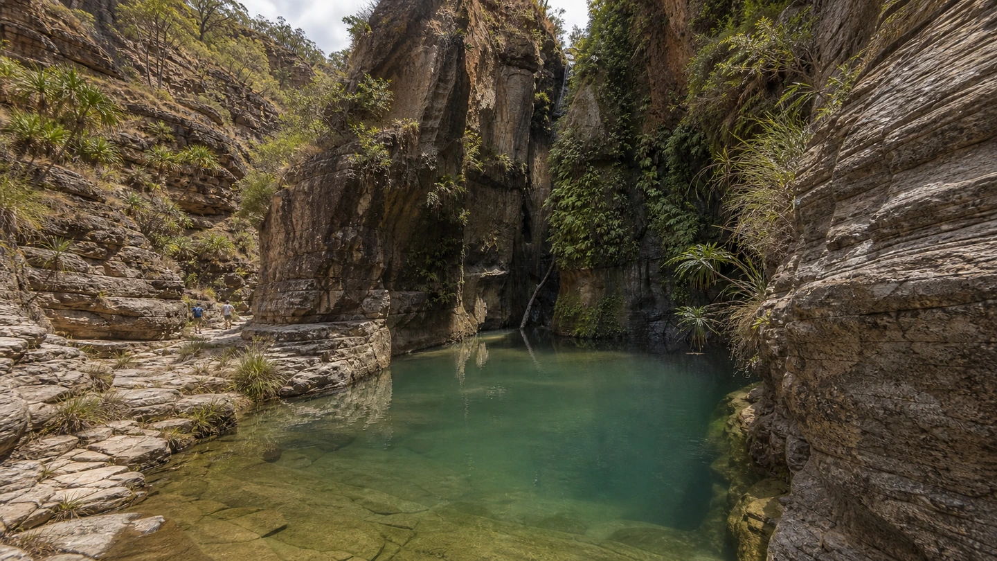
The day in Isalo begins among open grasslands and extraordinary sandstone formations. The trail crosses sun-warmed scenery, shaded gorges and unexpectedly green oases.

Depending on the chosen hike, you may reach Piscine Naturelle, Cascade des Nymphes or the forested areas of Namaza. After dusty trails and hot rock, the clear pools can feel almost unreal.

A local guide accompanies the hike and explains the plants, wildlife and significance of individual places. In the late afternoon, you return to Ranohira carrying the colours of the sandstone and the dust of the trail.

Natural pool and hikers among sandstone cliffs in Isalo National Park
Natural pools, canyons and open sandstone landscapes make Isalo a highlight of the RN7.
10

DAY 10 · ISALO · SECOND PARK DAY OR TIME TO REST

Experience Isalo without rushing

Distance
local transfers
Driving time
experience day without a long onward drive

A second day reveals another side of Isalo. Today’s route might lead deeper into a canyon, to a viewpoint over the plain or on a shorter circuit through the sandstone landscape.

After a long hike the day before, this day can also begin more slowly. A free morning, a short walk and time by the pool may be just as valuable as another full-day circuit.

When the evening light flattens, the rocks glow in warm shades of orange and red. Sunset at the edge of the massif is a memorable conclusion to the days in Ranohira.

11

DAY 11 · RANOHIRA → TOLIARA → IFATY

From Isalo to the southwest coast

Distance
approx. 275–300 km
Driving time
approx. 7–9 hours with stops

West of Ranohira, the landscape becomes drier still. The RN7 crosses broad plains past Sakaraha and the first plants of the southwest’s extraordinary spiny forest.

Zombitse-Vohibasia National Park lies along the way. A visit makes the day considerably longer; without it, there is more time to take in the changing landscapes along the road.

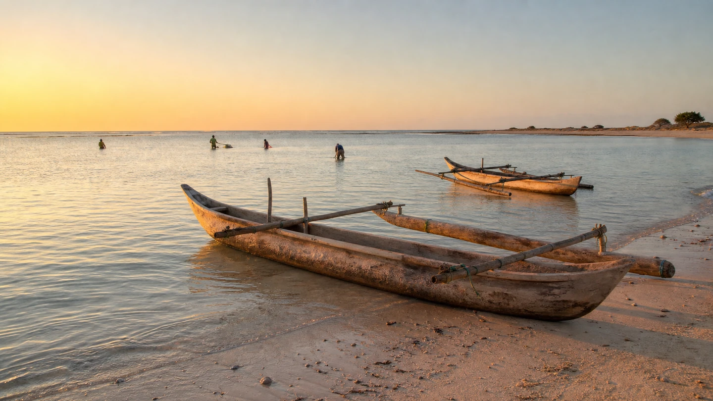
The sea is close beyond Toliara. The final kilometres lead north to Ifaty or Mangily, where pirogues rest in shallow water and the lagoon shimmers calmly in the evening light.

12

DAY 12 · IFATY · MANGILY · SPINY FOREST

Lagoon, Vezo coast and Reniala

Distance
local drives
Driving time
coast and relaxation day

The morning begins without packing luggage or facing a long road. Fishers head out in their pirogues, the lagoon lies calm behind the reef and the tides set the rhythm of the beach.

For one more nature experience, visit Réserve Reniala. Endemic birds, reptiles and small nocturnal lemurs live among immense baobabs and extraordinary thorny plants — a strong contrast to Ranomafana’s humid forest.

There is then time for the beach, a boat trip or simply a quiet afternoon by the sea. Two nights on the coast give the journey a relaxed ending rather than treating Ifaty only as a terminus.

Vezo pirogues in the shallow water near Ifaty at sunset
The road journey ends by the Ifaty and Mangily lagoon, among Vezo pirogues and calm water.
13

DAY 13 · IFATY → TOLIARA · OPTIONAL DOMESTIC FLIGHT

Flight to Antananarivo with a safety buffer

Distance
approx. 30–40 km by road
Driving time
approx. 1–2 hours transfer plus flight

After a final breakfast on the coast, you return to Toliara. If a domestic flight operates on your travel date, it takes you back to Antananarivo in the central highlands.

Within a short time, the dry coast gives way to the hills around the capital. A night in Antananarivo creates a buffer between the domestic and international flights.

If no suitable flight is available on your date, additional days are needed for the overland return. The flight schedule is therefore one of the details that should be confirmed before booking.

14

DAY 14 · ANTANANARIVO · IVATO · ONWARD JOURNEY

Departure or extension

Distance
transfer depends on the accommodation
Driving time
depends on departure time and traffic

On day fourteen, the RN7 journey ends with the transfer to Ivato Airport. Almost a thousand kilometres of Madagascar now lie behind you, from rainforest and sandstone to the coast.

If your flight leaves late, there may be time for crafts, a market or one last view over Antananarivo’s hills before travelling to the airport with sufficient time.

If you are not ready to leave, add days in another region. The RN7 ends here, but the island certainly does not.

Why 14 days work well for the RN7

The RN7 can be driven faster, but there would be little time to experience it. Fourteen days give Ranomafana, Ambalavao and Isalo the attention they deserve while leaving lighter days between longer drives.

The journey begins gently in Antananarivo, includes full nature days and ends with two nights on the coast. A night in the highlands also remains before the international flight instead of placing two separate flights too close together.

Best time for the RN7, Isalo and Ifaty

The drier months from May to October are especially well suited to this route. Highland mornings and nights can be surprisingly cool, while Isalo and the southwest coast are generally much warmer by day.

Rain, roadworks and damaged sections can change the pace even on the RN7. Stages are therefore planned around the season and adjusted to current conditions along the way.

How demanding is the southern route?

The journey combines long road days with active nature experiences. Rainforest trails can be wet and full of roots, while Isalo adds sun, heat and uneven sandstone.

You do not need to be an extreme athlete. Shorter and longer circuits offer different levels of difficulty, and the main hiking days are not followed by a rushed departure.

Why the national parks receive full days

A national park is not a roadside photo stop. Wildlife moves freely, trails change with the weather and the strongest experience often comes from taking your time.

A full day in Ranomafana and two days around Isalo turn the parks into genuine highlights. You are not hiking with one eye on the next departure, but can experience the scenery and wildlife at their own pace.

Why the RN7 is more relaxed with a driver

Even paved roads demand attention in Madagascar. Potholes, slow vehicles, people and animals on the road and unlit sections are all part of everyday driving on the RN7.

With an experienced driver, your attention stays on the landscape. You do not have to navigate after a long hike or organise parking, fuel stops and unfamiliar access roads.

Costs and the vehicle’s empty return journey

The price depends on the vehicle, trip length and preferred programme. Fuel, park entrance fees, local guides, accommodation and any domestic flight are itemised separately so you can see exactly what you are paying for.

If you fly back from Toliara, the 4x4 returns to Antananarivo without passengers. This generally requires one or two additional vehicle days plus fuel for the return, shown transparently in the quote from the start.

The route remains flexible

You may want longer in the rainforest, only one hiking day in Isalo or more time by the sea. Zombitse, additional highland stops or a longer stay can also be added.

These 14 days are a proven foundation. Depending on your interests, the trip can include more hiking, cultural stops or quiet nature days, always coordinated with the season and road stages.

YOUR JOURNEY · YOUR PACE

Would you like to experience the RN7?

Tell us when you want to travel and what matters most. Together, we will shape your personal route through the highlands, rainforest and Isalo to the sea.

PLANNING · PARKS · VEHICLE RETURN

Frequently asked questions

Fourteen days connect Antsirabe, Ranomafana, Fianarantsoa, Ambalavao, Isalo and Ifaty at a comfortable pace, including full nature days and two nights on the coast.

Free & non-binding

Plan your Madagascar trip