Skip to content
Mada Car Drive — logo
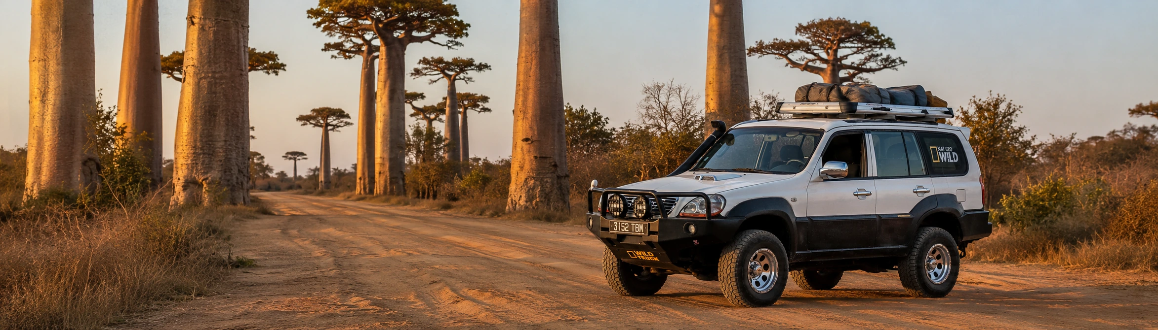
Mada Car Drive Hyundai Terracan on the Avenue of the Baobabs near Morondava in the evening light

ROUTE · THE WEST · 14 DAYS

14-Day Madagascar Tour: Baobab Avenue, Kirindy & Tsingy

This 14-day Madagascar tour takes you by 4x4 with an experienced driver-guide from the highlands via Morondava and Kirindy to the limestone pinnacles of Tsingy de Bemaraha.

14 daysduration
4x4with driver
May–Novembergeneral season
Tsingyhighlight

WESTERN MADAGASCAR · 4x4 WITH DRIVER

A 14-day journey through western Madagascar

Western Madagascar is a journey of striking contrasts. It leads from the cool highlands down to the warm coast at Morondava, into Kirindy’s dry forest and finally among the spectacular limestone pinnacles of Tsingy de Bemaraha.

Fourteen days connect Antsirabe, Miandrivazo, baobabs, nocturnal wildlife and two full days in the Tsingy region. Rice fields, savannah, red earth, river ferries and small towns alternate along the way, revealing a different side of the island on every stage.

You travel by 4x4 with an experienced driver. That leaves you free to take in the landscapes and encounters while departure times, ferries and the most practical order of the stages are managed along the way.

14 STAGES · HIGHLANDS · WEST COAST · TSINGY

The route at a glance

  1. 01

    Arrival in Antananarivo

    Ivato Airport · Antananarivo

  2. 02

    Through the highlands to Antsirabe

    Antananarivo → Antsirabe

    approx. 170–190 km · approx. 5–7 hours

  3. 03

    Antsirabe and Lake Tritriva

    Antsirabe · surroundings · Lake Tritriva

    local drives · day excursion

  4. 04

    From the highlands to Miandrivazo

    Antsirabe → Miandrivazo

    approx. 220 km · approx. 6–7 hours with stops

  5. 05

    Onwards to the west coast

    Miandrivazo → Morondava

    approx. 260–270 km · approx. 5–7 hours

  6. 06

    Between baobabs and dry forest

    Morondava → Kirindy Forest

    approx. 60 km · approx. 3 hours

  7. 07

    Via Belo-sur-Tsiribihina to Bekopaka

    Kirindy → Belo-sur-Tsiribihina → Bekopaka

    approx. 140 km · full road day; often 8 hours or more

  8. 08

    Petit Tsingy and the Manambolo

    Bekopaka · Tsingy de Bemaraha

    local transfers · experience day

  9. 09

    A full day in Grand Tsingy

    Grand Tsingy · national park

    local transfers · hiking day

  10. 10

    Return to Morondava

    Bekopaka → Belo-sur-Tsiribihina → Morondava

    approx. 200 km · full road day; often 9–11 hours

  11. 11

    Betania and a quiet day on the coast

    Morondava · Betania · coast

    local drives · day excursion

  12. 12

    Morondava or a flight back to Antananarivo

    Morondava · optional flight to Antananarivo

    depends on the option · no fixed road stage

  13. 13

    Antananarivo and a buffer before departure

    Antananarivo · Ivato

    local drives · buffer day

  14. 14

    Departure or extension

    Ivato · onward journey

    transfer depends on the accommodation · depends on departure time

All distances and driving times are approximate. Traffic, road conditions, weather and ferries can change the actual course of the day.

THE JOURNEY IN DETAIL

Day by day

01

DAY 01 · IVATO AIRPORT · ANTANANARIVO

Arrival in Antananarivo

After landing at Ivato Airport, your first stop is the accommodation, either near the airport or in Antananarivo depending on your arrival time. No long overland stage is planned for this day.

Between collecting your luggage, changing money and meeting the capital’s traffic for the first time, the journey begins quietly. Antananarivo lies in the central highlands, where dense neighbourhoods, rice fields on the city’s edge and steep hills shape the first impression.

In the evening, you agree the departure time and next stages with your driver. The journey south begins the following morning.
02

DAY 02 · ANTANANARIVO → ANTSIRABE

Through the highlands to Antsirabe

Distance
approx. 170–190 km
Driving time
approx. 5–7 hours

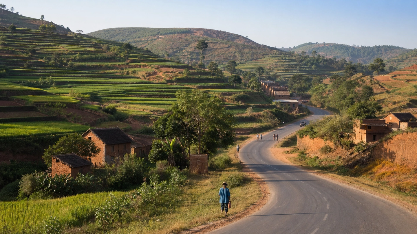
Beyond Antananarivo, the RN7 runs through the central highlands. The buildings thin out, terraced fields cover the slopes and brick houses, small towns and roadside markets appear between the rice fields.

This first road day is already rich in scenes along the way: traders at the edge of town, zebu carts between villages and viewpoints across the broad rice fields. There is time to stop at a market or for an especially good view.

You reach Antsirabe in the late afternoon or early evening. Broad streets, old façades, workshops and the city’s many pousse-pousses create a rhythm of their own. The evening is free for a first walk.

Highlands and rice fields along Madagascar’s RN7
Terraced fields and highland villages accompany the drive to Antsirabe.
03

DAY 03 · ANTSIRABE · SURROUNDINGS · LAKE TRITRIVA

Antsirabe and Lake Tritriva

Distance
local drives
Driving time
day excursion

The morning belongs to Antsirabe. Pousse-pousses move through the streets, small workshops work with metal, horn and wood, and markets and shops sit among the older façades.

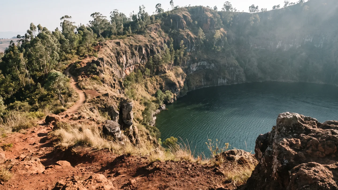
Later, you leave the city for Lake Tritriva, a crater lake in the volcanic landscape outside Antsirabe. The roads narrow on the way as fields and villages replace the through traffic of the RN7.

There is time to explore the surroundings and look down into the crater before returning to Antsirabe for a second night in the highlands.

Lake Tritriva crater lake near Antsirabe
Lake Tritriva lies in the volcanic landscape outside Antsirabe.
04

DAY 04 · ANTSIRABE → MIANDRIVAZO

From the highlands to Miandrivazo

Distance
approx. 220 km
Driving time
approx. 6–7 hours with stops

West of Antsirabe, the landscape changes gradually. The cooler highlands fall behind, the terrain becomes flatter, the vegetation drier and the temperatures warmer.

The road crosses small towns and long open sections shaped by fields, savannah and dry vegetation. The farther west you travel, the more clearly the scenery differs from the first days around Antananarivo and Antsirabe.

Miandrivazo is reached in the late afternoon or early evening. The air is noticeably warmer than in the highlands, and palms and drier vegetation define the surroundings. The evening stays quiet before the route continues to the west coast the next morning.

05

DAY 05 · MIANDRIVAZO → MORONDAVA

Onwards to the west coast

Distance
approx. 260–270 km
Driving time
approx. 5–7 hours

From Miandrivazo, the journey continues west. The landscape becomes more open and arid, settlements lie farther apart and the heat of the lower country accompanies the day’s drive.

The surroundings change again as you approach Morondava. Sandy roadsides, low buildings and warm coastal air finally replace the highlands.

Morondava lies on the Mozambique Channel and is the starting point for the coming stages to Kirindy and Tsingy de Bemaraha. The rest of the day remains free on the coast.

06

DAY 06 · MORONDAVA → KIRINDY FOREST

Between baobabs and dry forest

Distance
approx. 60 km
Driving time
approx. 3 hours

North of Morondava, the route moves onto unpaved sections. The baobabs of Menabe line the way: solitary giants, small groups and the famous Avenue of the Baobabs.

Today, however, the journey continues to Kirindy. There will be another chance to experience the avenue’s celebrated evening light on the return journey; day six is dedicated to the dry forest.

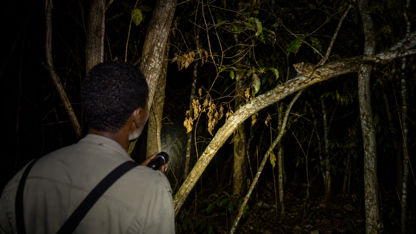
After dark, a local guide leads a night walk. In the beam of a torch, you may encounter mouse lemurs, chameleons, nocturnal reptiles and, with luck, even a fossa — one of the experiences for which Kirindy is renowned.

Kirindy dry forest during a guided night walk
After dark, the guided search for nocturnal wildlife begins.
07

DAY 07 · KIRINDY → BELO-SUR-TSIRIBIHINA → BEKOPAKA

Via Belo-sur-Tsiribihina to Bekopaka

Distance
approx. 140 km
Driving time
full road day; often 8 hours or more

Before departure, there may be time for another forest walk in the early morning. Different species are active in daylight, including, with some luck, sifakas in the dry canopy.

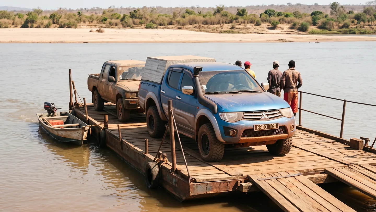
Beyond Kirindy begins the most adventurous road day of the trip. Red and sandy tracks cross open landscapes, and at Belo-sur-Tsiribihina local ferries carry vehicles and passengers across the river.

The route becomes more remote after Belo. By late afternoon or evening, the 4x4 reaches Bekopaka, the base for the coming days in Tsingy de Bemaraha.

Local ferry on the route between Kirindy and Bekopaka
Local ferries and waiting times are part of the slow track journey to Bekopaka.
08

DAY 08 · BEKOPAKA · TSINGY DE BEMARAHA

Petit Tsingy and the Manambolo

Distance
local transfers
Driving time
experience day

The first full day in the Tsingy region begins in the more accessible areas around Petit Tsingy. Sharp limestone, narrow passages and viewpoints over the dry forest already reveal the extraordinary character of this landscape.

Depending on the chosen programme, the day can be combined with a pirogue trip on the Manambolo. From the water, views open towards steep rock walls, vegetation and caves along the river.

The most suitable circuit depends on weather, park conditions and fitness. In the evening, you return to the accommodation in Bekopaka.

09

DAY 09 · GRAND TSINGY · NATIONAL PARK

A full day in Grand Tsingy

Distance
local transfers
Driving time
hiking day

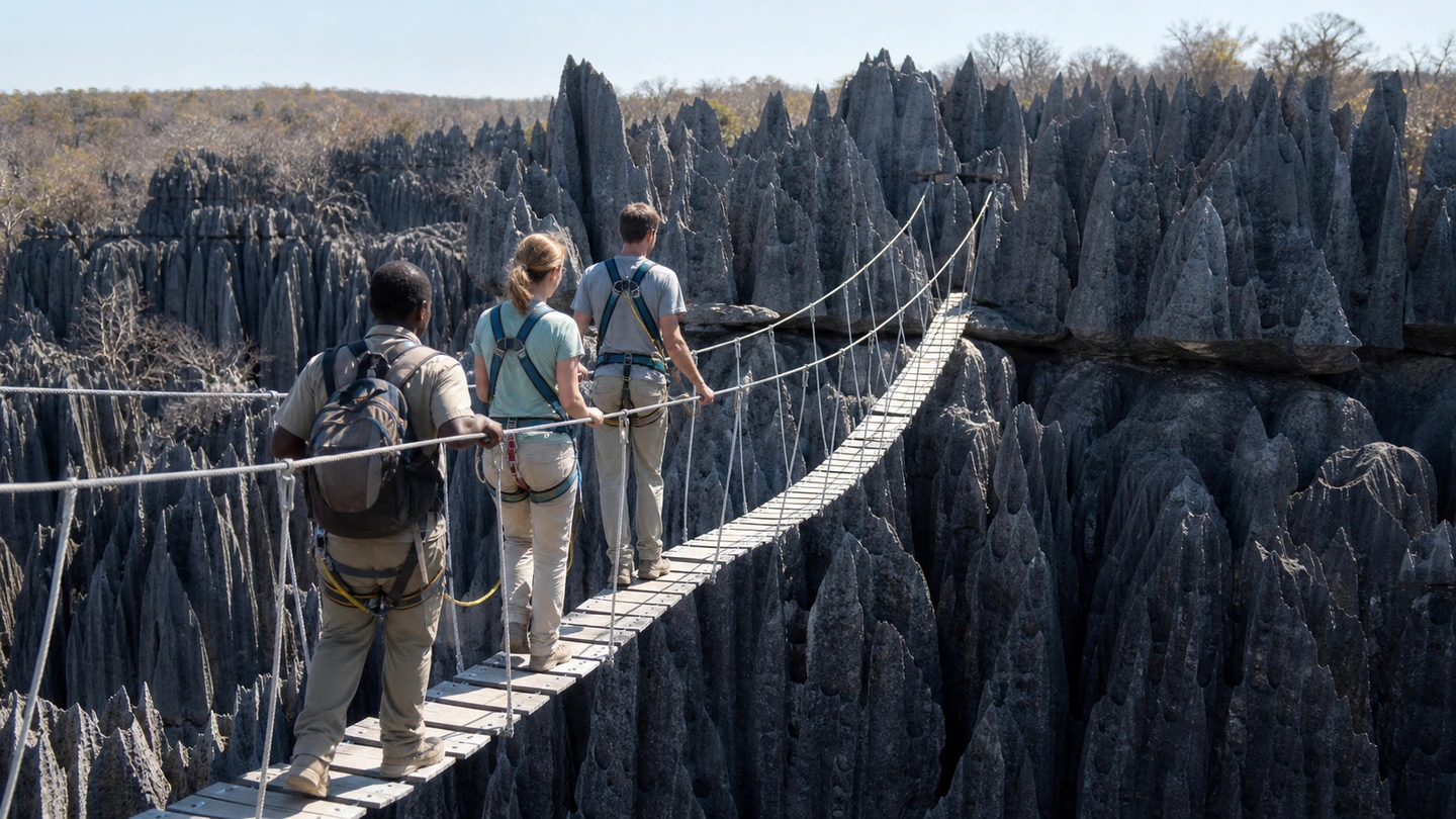
Grand Tsingy is the most physically demanding part of the route. The limestone landscape forms a system of pinnacles, fissures and rock walls; depending on the circuit, ladders, secured passages and suspension bridges are also involved.

Viewpoints open between the rocks across the karst and surrounding dry forest. Sturdy footwear, sure-footedness and an honest assessment of your fitness matter more than choosing the longest possible circuit.

Not every group needs to follow the same route. The appropriate circuit is selected on site with the responsible park guides.

Limestone pinnacles and suspension bridge in Tsingy de Bemaraha
Limestone pinnacles, secured passages and suspension bridges define Grand Tsingy.
10

DAY 10 · BEKOPAKA → BELO-SUR-TSIRIBIHINA → MORONDAVA

Return to Morondava

Distance
approx. 200 km
Driving time
full road day; often 9–11 hours

The return to the west coast begins in the morning. Ferries, villages and the broad dry landscape pass once more before the first baobabs appear on the horizon.

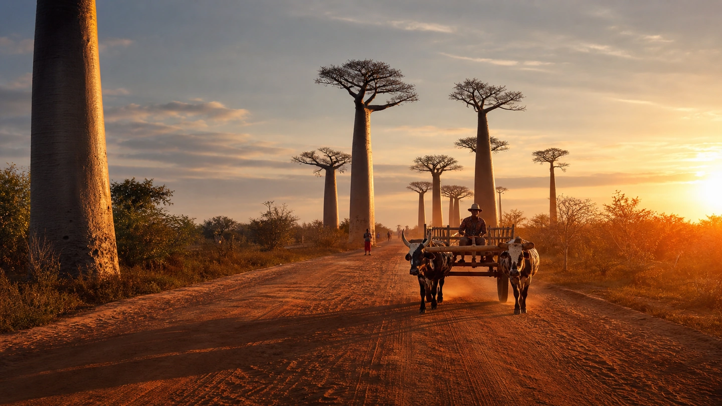
The great finale of the day is the Avenue of the Baobabs. In the warm evening light, the immense trunks cast long shadows across the red earth while zebu carts and travellers move between the trees.

After sunset, the final road section leads to Morondava. The intense Tsingy chapter ends back by the sea.

Avenue of the Baobabs near Morondava in warm evening light
If the day’s progress and light allow, the return journey ends at the Avenue of the Baobabs.
11

DAY 11 · MORONDAVA · BETANIA · COAST

Betania and a quiet day on the coast

Distance
local drives
Driving time
day excursion

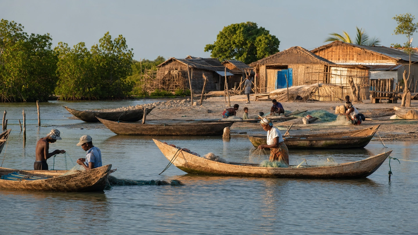
Day eleven belongs to Morondava and the coast. One possible excursion leads to Betania, a fishing village in the coastal area of the town.

Depending on the water level and local arrangements, the crossing is made by pirogue. Wooden boats rest in shallow water, nets are prepared or repaired and the daily lives of fishing families shape the village.

The rest of the day remains free on the coast. The beach, market or a fresh fish dinner provide a gentle close after Kirindy and Tsingy.

Wooden pirogues in Betania fishing village near Morondava
Wooden pirogues and fishing nets shape daily life in coastal Betania.
12

DAY 12 · MORONDAVA · OPTIONAL FLIGHT TO ANTANANARIVO

Morondava or a flight back to Antananarivo

Distance
depends on the option
Driving time
no fixed road stage

Day twelve remains flexible. Depending on the current flight schedule, a domestic flight to Antananarivo may be included. Operating days and departure times are checked for your actual travel date.

If there is no suitable flight, you can spend another day in Morondava or on the coast. An extension is also possible before the return to the highlands begins.

The chosen option depends on international connections, the overall trip length and your personal priorities.

13

DAY 13 · ANTANANARIVO · IVATO

Antananarivo and a buffer before departure

Distance
local drives
Driving time
buffer day

After a domestic flight, an additional day around Antananarivo creates a buffer before your international departure instead of leaving only a tight connection between two separate flights.

Depending on your interests, there is time for markets, crafts, viewpoints or a quiet day near the airport. After the long stages in the west, this day can deliberately remain light.

If you choose a different return option, the day is adjusted accordingly.

14

DAY 14 · IVATO · ONWARD JOURNEY

Departure or extension

Distance
transfer depends on the accommodation
Driving time
depends on departure time

On day fourteen, the route ends with the transfer to the airport. Departure time depends on your accommodation, traffic and international flight.

If you are staying longer in Madagascar, you can add extra days on the west coast or continue the journey in another region.

Mada Car Drive adapts the route to your available days, interests and preferred travel pace.

Why 14 days work well

Fourteen days give each landscape its own moment: the highlands around Antsirabe, the baobabs near Morondava, Kirindy’s nocturnal forest and the rock formations of Tsingy.

Two full days in Bekopaka leave time for different Tsingy circuits. Afterwards, the trip eases out through baobabs, the coast and Morondava instead of going straight from the final nature experience to departure.

Best time for the west and Tsingy

From May to around mid-November, the west is generally at its driest and sunniest. The tracks to Bekopaka open for the Tsingy season, pairing warm days with clear evening light among the baobabs.

September and October grow warmer, the dry forest becomes more active and the low sun colours the landscape especially intensely. The exact start of your trip is coordinated with seasonal conditions.

Tracks, limestone and vast landscapes

The days between Kirindy and Bekopaka feel like a small expedition: early starts, open landscapes, river ferries and the gradual approach to Tsingy.

In Grand Tsingy, circuits lead through narrow rock passages, over ladders and secured suspension bridges to broad viewpoints. You select the tour that matches your preferred activity level with the park guide on site.

A driver keeps the journey flowing

Between the highlands, ferries and dry forest, your driver knows practical departure times, good places for breaks and the routines at the river crossings.

Meanwhile, you can take photographs, watch the landscape and arrive with energy at the next stop. Even the driving days become a genuine part of the road trip.

What does the 14-day route cost?

The price depends on trip length, vehicle, route and any additional services. Vehicle and driver are calculated for the actual itinerary, while fuel is based on real consumption.

After your enquiry, Mada Car Drive prepares a transparent quote for your preferred route. Any domestic flight is planned separately.

The route remains flexible

More time in Antsirabe, extra beach days, a shorter Tsingy circuit or a different return journey can all be incorporated.

The key factors are your available days, the season and your personal interests. Together they shape an itinerary that suits your group.

PERSONALLY PLANNED · FLEXIBLE BY DESIGN

How much time should you allow for the west?

Mada Car Drive adapts each stage to your available time, season and interests — with a 4x4 and experienced driver.

PLANNING · TRACKS · TSINGY

Frequently asked questions

With Tsingy de Bemaraha included, 14 days is a sensible time frame. It allows for two full days among the limestone formations as well as the tracks to Bekopaka, Kirindy, the baobabs and Morondava.

Free & non-binding

Plan your Madagascar trip